Bell Creek Floodplain Mapping
Current Status - public information centre
When: December 2, 2025
Time: 5:00 p.m. – 7:30 p.m.
Location: Holy Trinity Evangelical Lutheran Church at 516 Victoria Ave, Belleville
Learn about the study, speak with Quinte Conservation staff & project consultants, and have your say.
Project Background
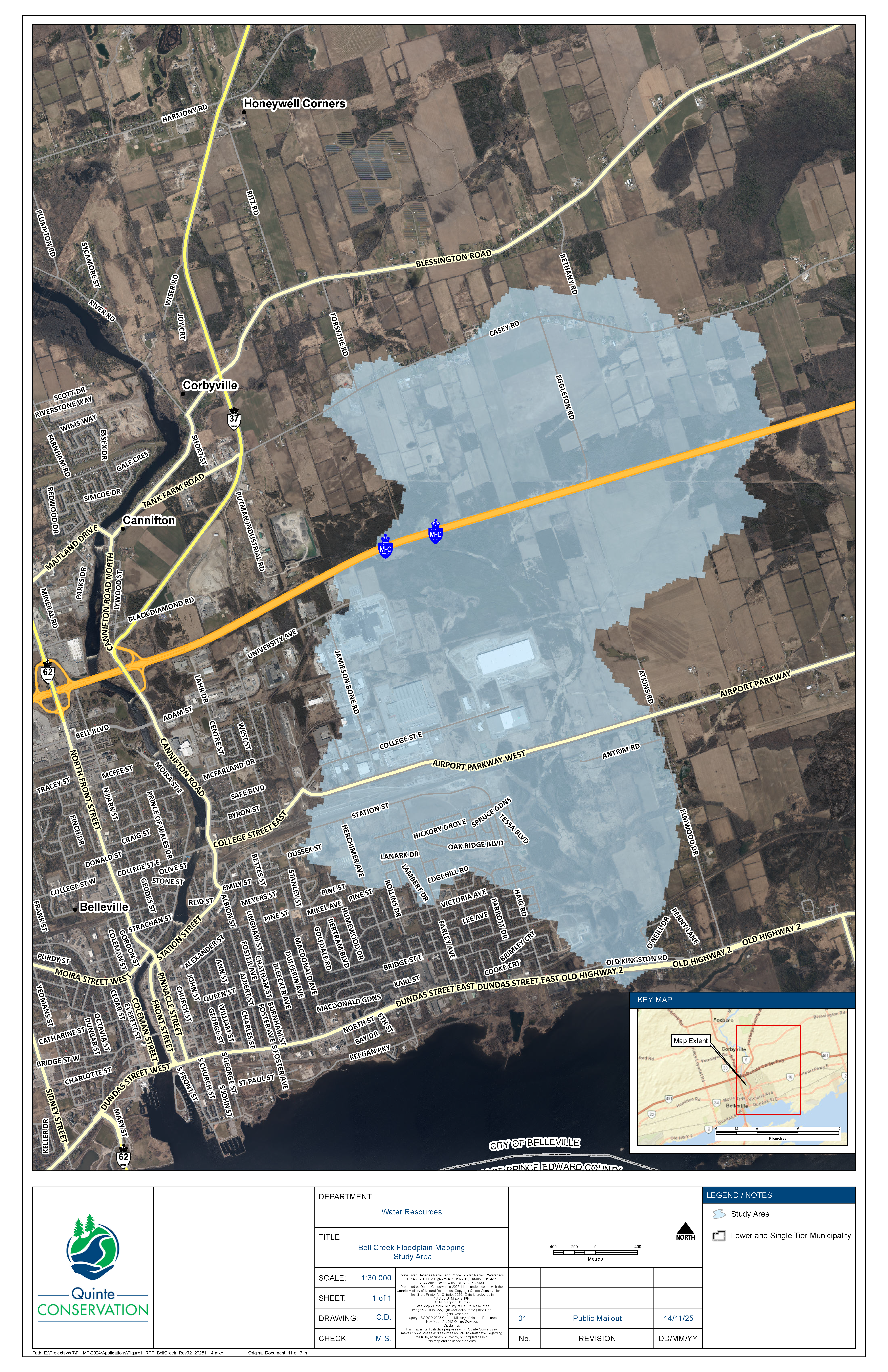
Quinte Conservation is inviting residents in the City of Belleville to engage in public consultations regarding updated floodplain mapping for areas along Bell Creek. This study aims to manage flood risk and ensure sustainable development practices for the region.
Natural hazard maps are important tools used by municipal governments, Conservation Authorities, and planning agencies to guide development, zoning, and emergency preparedness. These maps are used when reviewing development applications to assess natural hazards such as flooding, erosion, and steep slopes, which can pose risks to both people and property. For properties within the floodplain or associated setbacks, development requires approval from Conservation Authorities before building permits are granted.
The last floodplain mapping for Bell Creek was developed in 1984 and is being updated to reflect changes in land use and climate data. Using advanced floodplain mapping tools such as topography, bathymetry, water resource modeling, and field surveys, the study aims to accurately delineate flood-prone areas and provide a clearer understanding of flooding hazards during various storm events. This mapping will help to better inform future development decisions, land use planning, and flood mitigation strategies in the region.
This project is supported by the Government of Canada, the Province of Ontario and the City of Belleville.


Contact
Mike Smith
Capital Projects Coordinator
Phone: 613-968-3434 ext. 125
Email: msmith@quinteconservation.ca
Christine Phillibert
Water Resources Manager
Phone: 613-968-3434 ext. 130
Email: cphillibert@quinteconservation.ca