There are many dams in the Quinte watershed. Quinte Conservation owns and operates 40 dams and there are many other privately owned dams. An interactive map of Ontario dams is available through the Ontario Ministry of Natural Resources and Forestry.

Each dam owned by us provides one or more benefits. Examples include: flood management, raising low water levels, recreation, water supply, habitat creation, historic, and hydro power production. The dams were built decades ago. They need ongoing repairs to stay in good working order.

Dam operations

We follow operating plans for each dam. The plans tell us when to operate based on time of year or water level. The plans also tell us how to operate. These plans consider all water users and the health of the lakes and rivers.

Many of our dams are only operated in the spring and fall. In the fall, water levels are lowered above the dam to reduce winter ice damage and spring flooding. After the snow has melted in the spring, we operate the dams to maintain higher summer water levels on lakes and to raise low river levels during droughts.

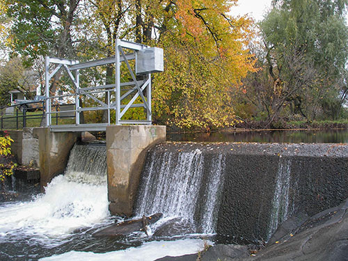
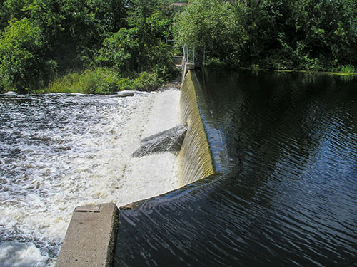
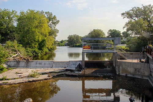
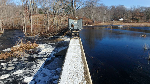
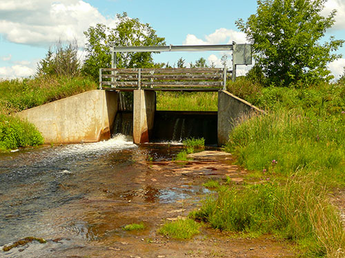
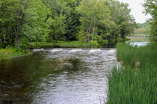
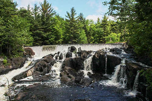
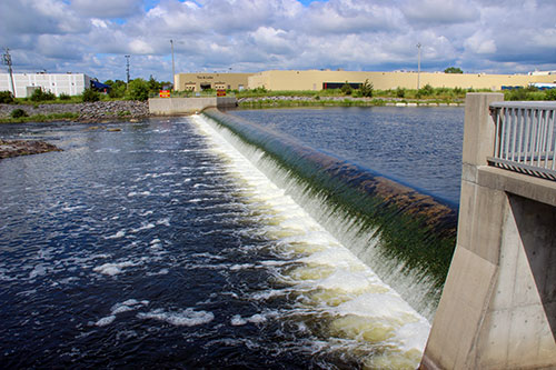
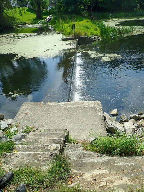
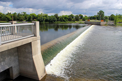
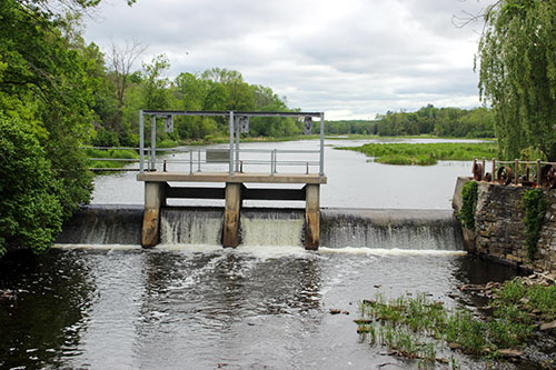
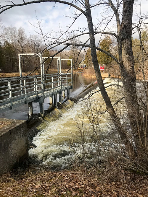
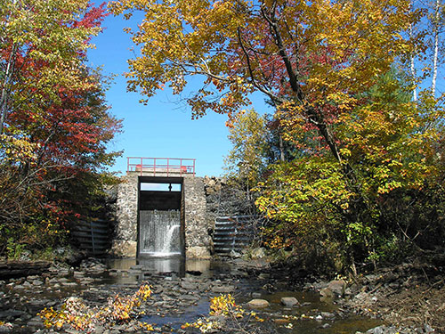
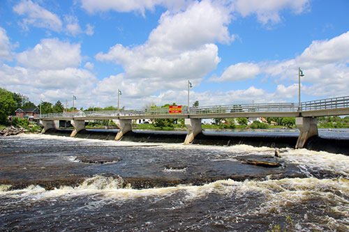
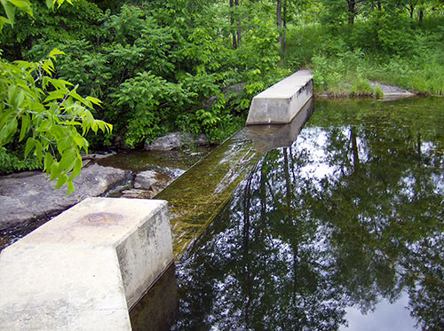
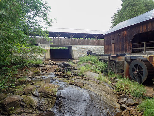
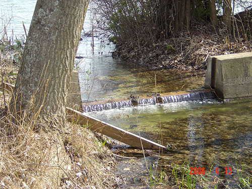
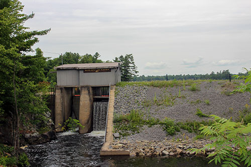
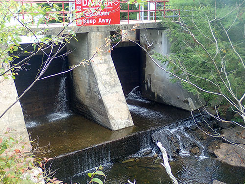
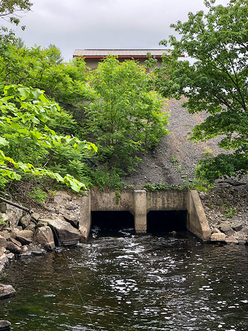
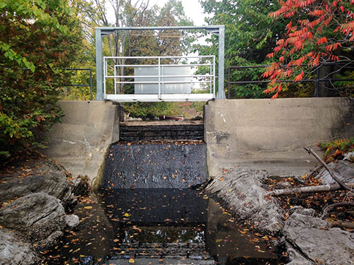
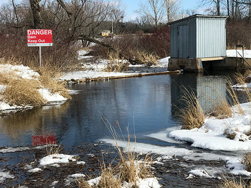
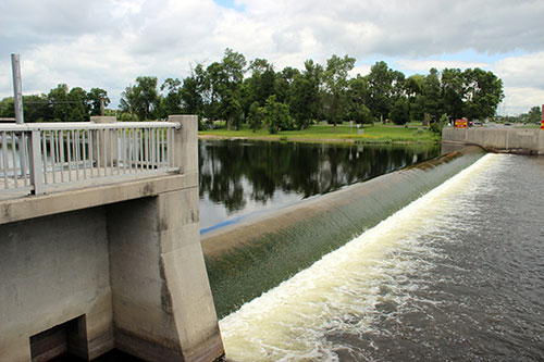
Our dams can be controlled by stop logs and panels, valves, or inflatable weirs. Some dams cannot be operated. These dams are referred to as weirs.

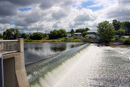
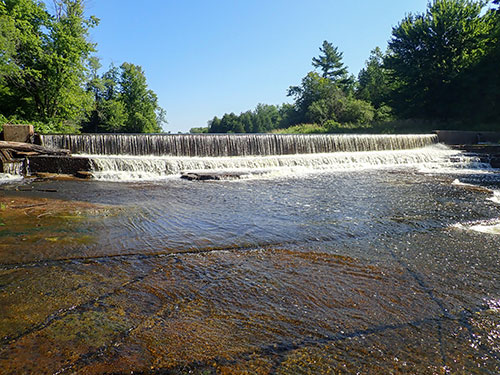
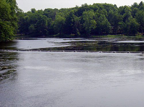
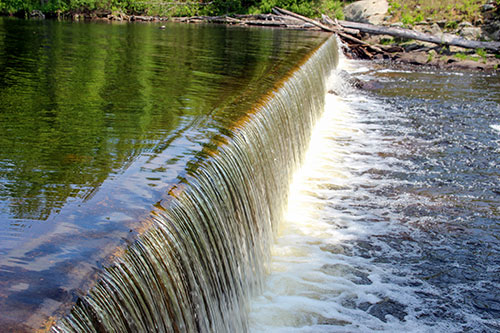
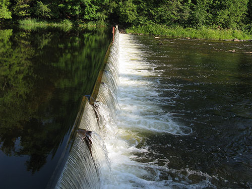
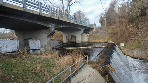
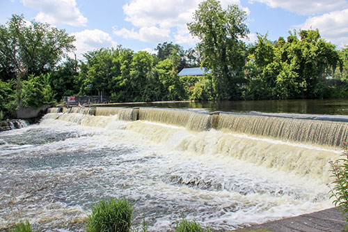
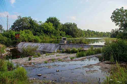
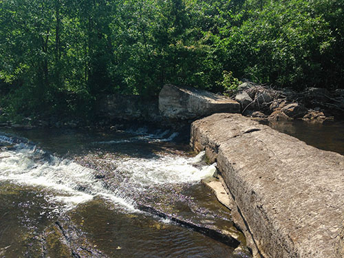
Weirs and dams that are only operated in the spring and fall are referred to as “run of the river” dams. This means that the dams do not change the flow in the river. All of the water that flows to the dam, flows over the dam, and continues downstream.

Water level management

Water levels are affected by many factors, such as rainfall and snowmelt, dam operations, ice jams, beaver activity, and evaporation. Rainfall and snowmelt often increase water levels on lakes and rivers. Dam operations can raise and lower water levels above and below the dam. Ice jams can cause a rise in water levels directly behind the ice jam. Beaver dams can cause a rise in water levels above the dam and lower water levels downstream.

Our dams affect water levels immediately upstream, this is called the headpond. Water travels downstream because of gravity. If you are interested in knowing how big the headpond of a dam is, travel upstream until you see water flowing downhill (this can look like a section of rapids or water flowing over another dam). The dam does not back water up over the rapids or the dam.

Flood management

Some of our dams can assist in flood management by collecting and holding excess water in the dam headpond. This reduces the water flowing through the river channel during the flood. A headpond can only hold a certain amount of water before it floods upstream, or high water levels washout the dam. Extreme rainfalls and snowmelts may contain too much water for our dams to stop flooding. The headpond can only collect water that drains to it. A flood caused by local rainfall downstream cannot be protected by the dam. We strive to provide flood management with our dams, but we are limited by the size of the headpond, and the location of rainfall or snowmelt.

Drought management

During droughts we operate some dams to increase water levels in the river. The amount of water in the headpond determines how much water is available to assist the river. The shape of the dam outlet and the operation determines how long river levels will be improved.

Ice management

As a result of historic ice jam floods, dams were built to reduce the risk of ice jams. These dams do three things:

  1. The dams create a stable water level in steep areas that would otherwise have turbulent rapids. The calm water allows an ice sheet to form.
  2. The ice sheet insulates fast flowing water from frigid, cold air that can cause frazil ice to form and jam.
  3. Floating ice booms are strung across the river upstream of the dam. The ice booms hold the ice sheet and ice chunks in place to limit travel and ice jamming downstream.

Hydro power

We own and operate one hydro-electric dam, McLeod Dam. The green energy facility started making power in 2008. The original dam was updated with two turbines and generators that harness the renewable energy which is distributed locally. The dam makes enough energy to power 400 homes.

Our dams

Arthur Holgate Dam

River Dam

Location: Moira River in the Hamlet of Cannifton, Thurlow Ward, City of Belleville. 

Year of construction: 1988.

Description: Concrete weir with two gates.

Purpose: Ice management and recreation.

Operation: This dam is not operated.

Beaver Meadow

Wetland Dam

Location: Beaver Meadow Conservation Area, Athol, Prince Edward County.

Year of construction: 1982.

Description: Small concrete weir with stop logs.

Purpose: Recreation, low flow, habitat for waterfowl.

Operation: Logs are in place year round. Logs may be removed during high water. Logs are removed for habitat management on a ten year cycle.

Bellrock Main and Mill Dam

Dam

Location: Depot Creek at Bellrock, Township of South Frontenac.

Year of construction: 1958.

Description: The main dam is a small concrete dam with stop logs and an overflow spillway. The mill dam is a small concrete dam with stop logs.

Purpose: The dam was built for the mill operation. Now the dam provides water supply to local residents, and limited recreation.

Operation: This dam is operated when water levels are outside of the operating range.

More information: The mill is not owned by Quinte Conservation.

Bloomfield Dam

Dam

Location: Bloomfield Mill Pond, Bloomfield, Prince Edward County.

Year of construction: 1975.

Description: Earth dam with a drop inlet, low flow valve, and channel.

Purpose: Water supply for fire protection, recreation and habitat creation.

Operation: This dam is not operated.

Breeze Dam

Dam

Location: Salmon River near the Hamlet of Forest Mills, Town of Greater Napanee.

Year of construction: 1982 (replacement).

Description: Small concrete dam with stop logs and an overflow spillway.

Purpose: Recreation, low flow, and ice management.

Operation: Two logs are removed prior to the winter. The logs are replaced after the snow melt. This dam maintains summer water levels.

Caton's Weir

Dam

Location: Downstream of Stoco Lake on the east branch of Lost Channels of the Moira River, upstream of Caton's bridge, Municipality of Tweed.

Year of construction: 1968.

Description: Concrete dam with wooden panels.

Purpose: The dam maintains summer water levels on Stoco Lake.

Operation: The seasonal weir is installed in early summer and removed in late fall.

Chapman's Weir

Weir

Location: Downstream of Stoco Lake on the west branch of Lost Channels of the Moira River, downstream of Chapman's bridge, Municipality of Tweed.

Year of construction:

Description: Concrete weir.

Purpose: This dam maintains summer water levels on Stoco Lake.

Operation: This weir cannot be operated.

Colebrook Dam

Dam

Location: Napanee River, Hamlet of Colebrook, Township of Stone Mills.

Year of construction: 1836.

Description: Concrete dam with stop logs and an overflow spillway.

Purpose: The dam was built to provide water power for a saw and grist mill. Now the dam provides recreation, such as, swimming, boating, and limited fishing.

Operation: This dam is only operated for maintenance.

Consecon Mill Dam

Dam

Location: Consecon Creek, Consecon, Prince Edward County.

Year of construction: 1975 (replacement).

Description: Concrete dam with stop logs and an overflow spillway.

Purpose: The dam was built to replace a historic mill. Now the dam provides water for fire protection and limited recreation.

Operation: Logs are in place year round except during the snow melt.

Dead Creek Dam

Dam

Location: Dead Creek, Township of Central Frontenac.

Year of construction:

Description: Small concrete dam with stop logs and an overflow spillway.

Purpose: Habitat creation.

Operation: Logs are in place year round. Logs are removed every 10 years for habitat creation.

Deerock Lake Dam

Dam

Location: Outlet of Deerock Lake, flows into Partridge Creek, Addington Highlands.

Year of construction: 1969.

Description: Earth dam, valve and concrete spillway.

Purpose: Recreation, low flow, and habitat.

Operation: Water levels are lowered in the fall. Valve is closed after the snow melt. The valve is operated as needed to provide flow to the Skootamatta River in the summer.

Deloro Dam

Dam

Location: Moira River, 1.5 kilometres upstream of the Village of Deloro, Municipality of Marmora and Lake.

Year of construction: 1953.

Description: Concrete dam with two stop log bays.

Purpose: The dam was built to provide water to the Deloro Smelting and Mining Company. It is now used to assist with the Deloro Mine clean-up.

Operation: As requested by the Ontario Ministry of the Environment, Conservation, and Parks.

Demorestville Dam

Dam

Location: Fish Lake Creek, Demorestville Conservation Area, Demorestville, Prince Edward County.

Year of construction: 1978.

Description: Concrete dam with two stop log bays.

Purpose: Water supply for firefighting, local wells, and recreation.

Operation: Logs are removed prior to snow melt. Logs are in place in the summer.

Downey's Weir

Weir

Location: Outlet of Moira Lake on Moira River, upstream of Downey's Rapids, Municipality of Tweed.

Year of construction: 1964.

Description: Concrete dam with wooden panels.

Purpose: This dam maintains summer water levels on Moira Lake for recreation.

Operation: The seasonal weir is installed in early summer and removed in late fall.

Flinton Dam

Dam

Location: Located at Flinton Conservation Area off of Bridge Water Road in Flinton, Township of Addington Highlands.

Year of construction: 1920s.

Description: Concrete weir.

Purpose: Local water supply, and recreation for cottages, sport fishing, and tourism.

Operation: This dam cannot be operated.

George and Lois Wishart Dam

River Dam

Location: Moira River, 120 metres upstream of Highway 401, Thurlow Ward, City of Belleville.

Year of construction: 1990.

Description: Concrete weir with two gates.

Purpose: Ice management.

Operation: This dam is not operated.

Hardwood Creek Dam

Dam

Location: One kilometre south of the Town of Verona on Hardwood Creek, Central Frontenac Township.

Year of construction: 1965.

Description: Concrete weir and earth dam.

Purpose: Maintains summer water levels on upstream lakes.

Operation: This dam is not operated.

Harry Mulhall Dam

River Dam

Location: Moira River downstream of Highway 401, City of Belleville.

Year of construction: 1989.

Description: Concrete weir with two gates.

Purpose: Ice management.

Operation: This dam is not operated.

Harry Smith Dam

Dam

Location: Harry Smith Conservation Area, Village of Ameliasburgh, Prince Edward County.

Year of construction: Reconstructed in 2015.

Description: Earth dam with valve control.

Purpose: Built to power a grist mill. Now the dam provides fire protection, recreation and low flow.

Operation: This dam is operated for low flow for agricultural use.

James Lazier Dam

Dam

Location: Salmon River, Village of Lonsdale, Tyendinaga Township.

Year of construction: 1981 (reconstruction).

Description: Concrete weir with two stop log bays.

Purpose: Built to power a mill. Now the dam provides flood and ice management, recreation, and low flow.

Operation: In early summer, logs are installed in the dam. The south dam can be operated for low flow. There are no high flow operations. In the fall, some logs are removed from the dam. Two stop logs are set above the water level for the ice sheet to form against. These logs are removed before the winter thaw.

Kingsford Weir

Location: Salmon River at Kingsford Conservation Area, approximately 1 kilometer upstream of the Hamlet of Lonsdale, Tyendinaga Township.

Year of construction: 1971.

Description: Series of wooden panels.

Purpose: Recreation.

Operation: This dam is not operated anymore. The dam used to be installed in the early summer and removed in the late fall.

Laraby Rapids Dam

Dam

Location: 1.2 kilometres downstream of Beaver Lake, Township of Stone Mills.

Year of construction: 1975.

Description: Concrete weir and two stop log bays.

Purpose: Recreation, fisheries, and flow augmentation.

Operation: Typically, logs are removed in the fall and replaced in the spring. Logs are removed to let water downstream when flows are low. Logs are removed if water levels get too high.

Lingham Lake Dam

Dam

Location: Outlet of Lingham Lake on Black River, Grimsthorpe Township, Municipality of Tweed.

Year of construction: 1925.

Description: Rock crib dam, stop logs and earth saddle dams.

Purpose: Low flow, recreation, and fisheries.

Operation: Stop logs are installed after the spring freshet. During the summer months, water levels are lowered to maintain flow in the Black River. Stop logs are removed in the fall.

Lott Dam

River Dam

Location: Moira River, 400 metres upstream of Pinnacle Street Bridge, City of Belleville.

Year of construction: 1979.

Description: Concrete weir with two gates.

Purpose: Ice management.

Operation: This dam is not operated.

Lower Arden Dam

Dam

Location: Arden Creek, 150 metres downstream of Middle Arden Dam, Hamlet of Arden, Township of Central Frontenac.

Year of construction:

Description: Concrete weir and spillway.

Purpose: Built to power a mill. Now provides local water supply and limited recreation.

Operation: This dam is only operated for maintenance.

Macaulay Mountain Dam

Dam

Location: Macaulay Creek, Macaulay Conservation Area, Hallowell Ward, Prince Edward County.

Year of construction: 1973.

Description: Earth dam and outlet culvert.

Purpose: Flood management, fire protection, and recreation.

Operation: This dam is not operated.

McLeod Dam

River Dam

Location: Moira River, 200 metres upstream of College Street, City of Belleville.

Year of construction: 1979, updated in 2007-2008 for hydro power.

Description: Embankment dam, inflatable weir, and two gates in front of the hydro power turbines.

Purpose: Ice management, hydro power, and recreation.

Operation: This dam is operated to produce hydro power. The operating plan has maximum water levels and minimum downstream flows.

Middle Arden Dam

Dam

Location: Between Big Clear Lake and Arden Lake, 45 metres downstream of Upper Arden Dam, Hamlet of Arden, Township of Central Frontenac.

Year of construction:

Description: Stop log dam within the Township Road bridge.

Purpose: Recreation and water supply.

Operation: Two logs are removed prior to the winter. The logs are replaced after the snow melt.

Milford Dam

Dam

Location: North of Black River, South Marysburgh Ward, Prince Edward County.

Year of construction: 1981.

Description: Concrete weir.

Purpose: Built for historic mill. Now the dam provides recreation upstream and water supply for fire protection.

Operation: This dam is not operated.

O'Hara Mill Dam

Dam

Location: Deer Creek, O'Hara Mill Pioneer Village and Conservation Area, Madoc Township.

Year of construction: Reconstructed in 2010.

Description: Concrete dam with stop logs and mill sluice.

Purpose: Recreation and historic.

Operation: The headpond water levels are maintained within the seasonal operating ranges. This includes removing 2 of the 5 stop logs in the fall and replacing them following the spring freshet. 

Roblin Lake Dam

Lake Dam

Location: Outlet of Roblin Lake, off of County Road 19, Ameliasburgh, Prince Edward County.

Year of construction: 1988.

Description: Concrete weir with stop logs.

Purpose: Municipal water supply, recreation, and low flow.

Operation: Logs are installed in the spring and removed in the fall to maintain summer water levels.

Second Depot Lake Dam

Lake Dam

Location: Outlet of Second Depot Lake into Depot Creek, 11 kilometres northwest of Verona, Township of Central Frontenac.

Year of construction: 1958.

Description: Large earth dam, two stop log bays, and a valve.

Purpose: Flood management, low flow, recreation, habitat, and water supply for the Town of Greater Napanee.

Operation: Operated with Third Depot Lake Dam. Water levels are maintained in the operating range, with lower levels in the winter and higher levels in the summer. The dam is operated to provide flow to the Napanee River during low water.

Skootamatta Lake Dam (owned by Ministry of Natural Resources and Forestry)

River Dam

Location: Outlet of Skootamatta Lake into Skootamatta River, Township of Addington Highlands.

Year of construction: 1955.

Description: Concrete dam, two stop log bays, an overflow spillway, and two saddle dams.

Purpose: Recreation, fisheries, habitat, low flow, and flood management.

Operation: Logs are removed in the fall. After the snow melt, logs are replaced. Logs are adjusted in the summer to maintain summer water levels and flow in the Skootamatta River.

Springside Dam

Dam

Location: Napanee River, Town of Napanee.

Year of construction: 1979.

Description: Concrete weir, and stop logs.

Purpose: First built in 1786 to power a saw mill. Now provides water supply and recreation.

Operation: This dam is not operated.

Third Depot Lake Dam

Lake Dam

Location: Outlet of Third Depot Lake into Depot Creek, 16 kilometres northwest of Verona, Township of Central Frontenac.

Year of construction: 1975.

Description: Large earth dam with two valves.

Purpose: Flood management, low flow, and recreation.

Operation: Operated with Second Depot Lake Dam. Water levels are maintained in the operating range, with lower levels in the winter and higher levels in the summer. The dam is operated to provide flow to the Napanee River during low water.

Thirteen Island Lake Dam

Dam made of 3 concrete culverts

Location: Outlet of Thirteen Island Lake Dam into Hardwood Creek, Township of South Frontenac.

Year of construction: Reconstructed in 2022.

Description: Earth dam with three concrete culverts with integral log system.

Purpose: Recreation and low flow.

Operation: All logs are removed in the fall. After the snow melts, the logs are installed. During high summer water levels, logs may be removed.

Upper Arden Dam

Dam

Location: Outlet of Big Clear Lake, upstream of Arden Lake, Hamlet of Arden, Township of Central Frontenac.

Year of construction:

Description: Concrete dam with stop logs.

Purpose: Water supply, and recreation.

Operation: Water levels are lowered in the fall and winter to prepare for the spring snow melt. Logs are placed in the dam after the snow melt. Low flow on the Salmon River is improved by making space between the logs or removing logs. High fall flows may require more logs to be removed.

Varty Lake Dam

Dam

Location: 200 metres downstream of the outlet of Varty Lake, Township of Stone Mills.

Year of construction: 1972.

Description: Concrete dam with stop logs.

Purpose: Flood management, recreation, and habitat creation.

Operation: Logs are removed in the fall and replaced after the snow melt. More logs may be removed during large snow melts or rainfalls. A gate valve may assist with low flow.

Whitney Memorial Dam

Dam

Location: Outlet of Consecon Lake, Consecon, Prince Edward County.

Year of construction: 1978.

Description: Concrete weir, spillway, three low flow valves, and earth dam.

Purpose: Flood management, low flow, recreation and habitat recreation.

Operation: This dam is not operated.

Woods Dam

Woods Dam 2023

Location: Salmon River, southwest edge of the Hamlet of Roblin, Town of Greater Napanee.

Year of construction:

Description: Concrete dam and spillway.

Purpose: Built to power a mill. Now the dam provides recreation and water supply.

Operation: This dam is not operated.

Yardmen Dam

River Dam

Location: Moira River, upstream of former Lazier Dam site, City of Belleville.

Year of construction: 1987.

Description: Concrete weir with two gates.

Purpose: Ice management.

Operation: This dam is not operated.

Dam regulation

The Ontario Ministry of Natural Resources and Forestry regulates dam management.

Ontario dam owners may also follow the guidance from the Canadian Dam Association.

Safety around dams

Always exercise caution when boating, hiking or fishing near dams.

Stay off the dam unless the area is clearly marked for public travel.

Be alert to changes in water levels.

Read and pay attention to warning signs near dams.

Learn more about how to be safe around dams with help from the Ontario Ministry of Natural Resources and Forestry.