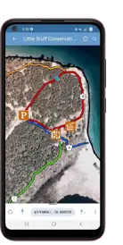
Mobile Trail Maps
Smartphone enabled maps are available for the following conservation areas:
- Beaver Meadow
- Depot Lakes
- H.R. Frink Centre
- Little Bluff
- Macaulay Mountain
- Massassauga Point
- O'Hara Mill Homestead
- Potter's Creek North
- Potter's Creek South
- Sheffield
- Sidney
- Vanderwater
These maps are accessible via Avenza Maps, a free mobile app. Once a map is downloaded through this app, no cellular data is required to track your location while on the trails.

How to use Avenza Maps:
- Install Avenza Maps on your smartphone (available on iOS and Android)
- Open the app and tap the store button on the bottom right.
- Search for a conservation area in the search bar.
- Tap the conservation area to go to its page.
- Tap the Free button to download the conservation area's map.
- Access the map offline at the area, ensuring location services on your phone are turned on.
Alternatively:
- Tap My Maps icon located at the bottom left of your screen.
- Tap the + button at the top right of the My Maps page, then select Import Maps
- Tap the QR Code icon at the top right and scan QR code provided on a Quinte Conservation Area webpage.
- Use the map offline at the area, ensuring that location services are turned on.


